
Fasciculus:Occitania blanck map.PNG
Nulla maior resolutio exstat.
Occitania_blanck_map.PNG (573 × 397 elementa imaginalia, magnitudo fasciculi: 10 chiliocteti, typus MIME: image/png)

|
This linguistic map image could be re-created using vector graphics as an SVG file. This has several advantages; see Commons:Media for cleanup for more information. If an SVG form of this image is available, please upload it and afterwards replace this template with
{{vector version available|new image name}}.
It is recommended to name the SVG file “Occitania blanck map.svg”—then the template Vector version available (or Vva) does not need the new image name parameter. |
Summarium
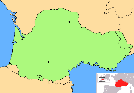
| Descriptio | Correct map of Occitania, with geographic context and remarking of the country borders |
| Datum | |
| Fons | Opus proprium |
| Auctor | Norrin strange |
| Other versions | Derivative works of this file: Occitania aranes map.png |
I, the copyright holder of this work, hereby publish it under the following licenses:

|
Licet hoc documentum exscribere vel distribuere vel demutare sub GNU Liberarum Litterarum Licentiae conditionibus in editione 1.2 aut in ulla editione recentiori a Fundatione Liberarum Programmationis Partium publicata; praeterquam Sectiones Immutabiles et Verba Involucra Adversa et Aversa. Licentiae exemplar praesto est in sectione intitulata GNU Free Documentation License. |
| This file is licensed under the Creative Commons Attribution-Share Alike 3.0 Unported license. | ||
| ||
| This licensing tag was added to this file as part of the GFDL licensing update. |
Tibi typum permissionis ligere licet.
Historia fasciculi
Presso die vel tempore fasciculum videbis, sicut tunc temporis apparuit.
| Dies/Tempus | Minutio | Dimensiones | Usor | Sententia | |
|---|---|---|---|---|---|
| recentissima | 18:30, 27 Iunii 2023 | | 573×397 (10 chiliocteti) | Jfblanc | Improved boundaries |
| 22:10, 4 Septembris 2020 |  | 573×397 (4 chiliocteti) | TSamuel | Minimized colors to 7 to recompress further | |
| 22:08, 4 Septembris 2020 |  | 573×397 (5 chiliocteti) | TSamuel | Losslessly recompressed | |
| 16:32, 17 Februarii 2009 |  | 573×397 (12 chiliocteti) | Tripallokavipasek | ||
| 15:21, 14 Iulii 2007 |  | 573×397 (11 chiliocteti) | Norrin strange | {{Information |Description=Correct map of Occitania |Source=self-made |Date=14-07-07 |Author= Norrin strange }} {{GFDL-Self}} |
Nexus ad imaginem
Paginae insequentes huic imagini nectunt:
Usus fasciculi per inceptus Vicimediorum
Quae incepta Vici fasciculo utuntur:
- Usus in ace.wikipedia.org
- Usus in ady.wikipedia.org
- Usus in am.wikipedia.org
- Usus in an.wikipedia.org
- Usus in ar.wikipedia.org
- Usus in be.wikipedia.org
- Usus in br.wikipedia.org
- Usus in ca.wikipedia.org
- Usus in ce.wikipedia.org
- Usus in ckb.wikipedia.org
- Usus in cs.wikipedia.org
- Usus in cv.wikipedia.org
- Usus in cy.wikipedia.org
- Usus in da.wikipedia.org
- Usus in diq.wikipedia.org
- Usus in en.wiktionary.org
- Usus in eo.wikipedia.org
- Usus in eo.wikinews.org
- Usus in es.wikipedia.org
- Usus in et.wikipedia.org
- Usus in eu.wikipedia.org
- Usus in fa.wikipedia.org
- Usus in fi.wikipedia.org
- Usus in fr.wikipedia.org
- Usus in fr.wiktionary.org
- Usus in fur.wikipedia.org
- Usus in gd.wikipedia.org
- Usus in gl.wikipedia.org
- Usus in gv.wikipedia.org
- Usus in hr.wikipedia.org
- Usus in hr.wiktionary.org
- Usus in hsb.wikipedia.org
- Usus in hu.wikipedia.org
- Usus in hy.wikipedia.org
- Usus in id.wikipedia.org
- Usus in ilo.wikipedia.org
- Usus in io.wikipedia.org
View more global usage of this file.